

(Photo taken on 17-12-2021. More pictures on that page)
(click picture to enlarge, click browser go-back-arrow to return)
|
The
bordermarkers of Moresnet
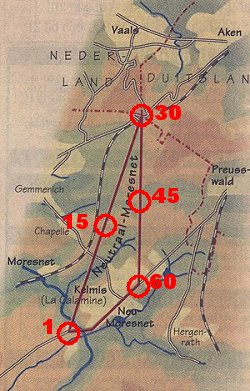
Moresnet was a tiny neutral state that existed from 1815 until 1919. This triangle-shaped mini-state was connected in the north to the current BEDENL-tripoint and was some 3 square km large. It was demarcated by 60 bordermarkers. (website by Eef Berns, created in 2022, part of www.grenspalen.nl, contact: eefberns@grenspalen.nl) |
||||||||||||||||||||||||||||||||||||||||||||||||||||||||||||||||||||||||||||||||||||||||||||||||||||||||||||||||||||||||||||||||||||||||||||||||||||||||||||||||||||||||||||||||||||||||||||||||||||||||||||||||||||||||||||||||||||||||||||||||||||||||||||||||||||||||||||||||||||||||||||||||||||||||||||||||||||||||||||||||||||||||||||||||
|---|---|---|---|---|---|---|---|---|---|---|---|---|---|---|---|---|---|---|---|---|---|---|---|---|---|---|---|---|---|---|---|---|---|---|---|---|---|---|---|---|---|---|---|---|---|---|---|---|---|---|---|---|---|---|---|---|---|---|---|---|---|---|---|---|---|---|---|---|---|---|---|---|---|---|---|---|---|---|---|---|---|---|---|---|---|---|---|---|---|---|---|---|---|---|---|---|---|---|---|---|---|---|---|---|---|---|---|---|---|---|---|---|---|---|---|---|---|---|---|---|---|---|---|---|---|---|---|---|---|---|---|---|---|---|---|---|---|---|---|---|---|---|---|---|---|---|---|---|---|---|---|---|---|---|---|---|---|---|---|---|---|---|---|---|---|---|---|---|---|---|---|---|---|---|---|---|---|---|---|---|---|---|---|---|---|---|---|---|---|---|---|---|---|---|---|---|---|---|---|---|---|---|---|---|---|---|---|---|---|---|---|---|---|---|---|---|---|---|---|---|---|---|---|---|---|---|---|---|---|---|---|---|---|---|---|---|---|---|---|---|---|---|---|---|---|---|---|---|---|---|---|---|---|---|---|---|---|---|---|---|---|---|---|---|---|---|---|---|---|---|---|---|---|---|---|---|---|---|---|---|---|---|---|---|---|---|---|---|---|---|---|---|---|---|---|---|---|---|---|---|---|---|---|---|---|---|---|---|---|---|---|---|---|---|---|---|---|---|---|---|---|---|---|---|---|---|---|---|---|---|---|---|---|---|---|---|
 The only reason of existence of Moresnet was
the local zinc mine, desired by both the Netherlands and Prussia after
the fall of Napoleon. Declaring the area neutral was a compromise and was laid
down in the Aachen border agreement. Often referred to it as a neutral
state ('Neutral Moresnet'), it might be better described as a condominium. The only reason of existence of Moresnet was
the local zinc mine, desired by both the Netherlands and Prussia after
the fall of Napoleon. Declaring the area neutral was a compromise and was laid
down in the Aachen border agreement. Often referred to it as a neutral
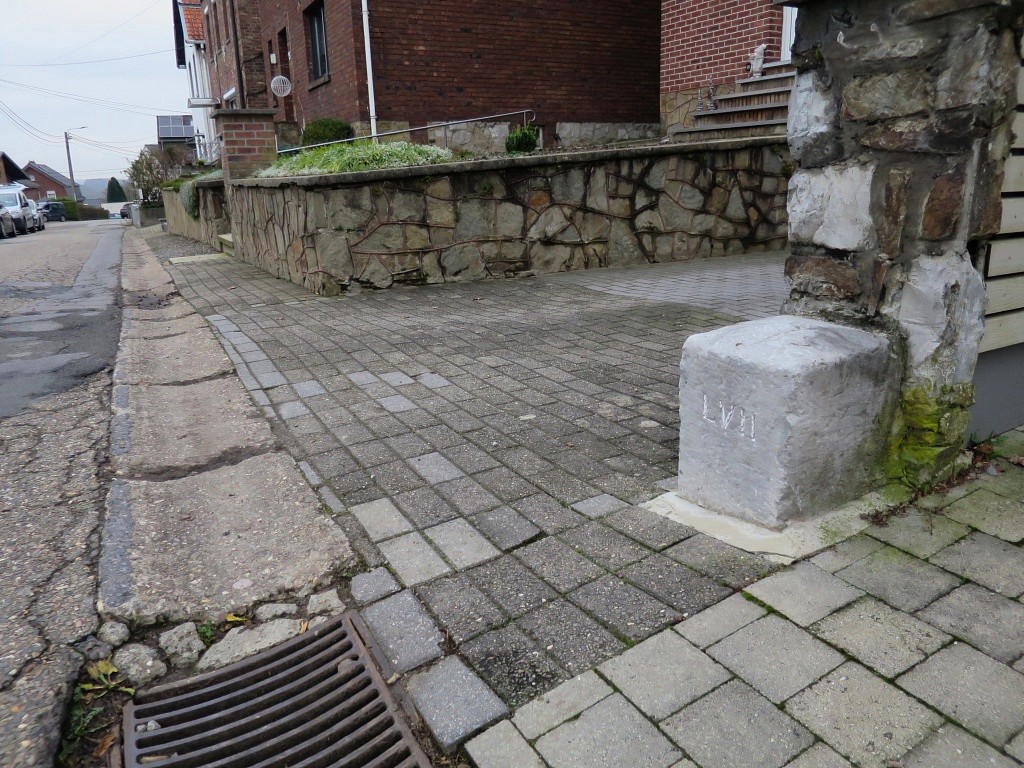
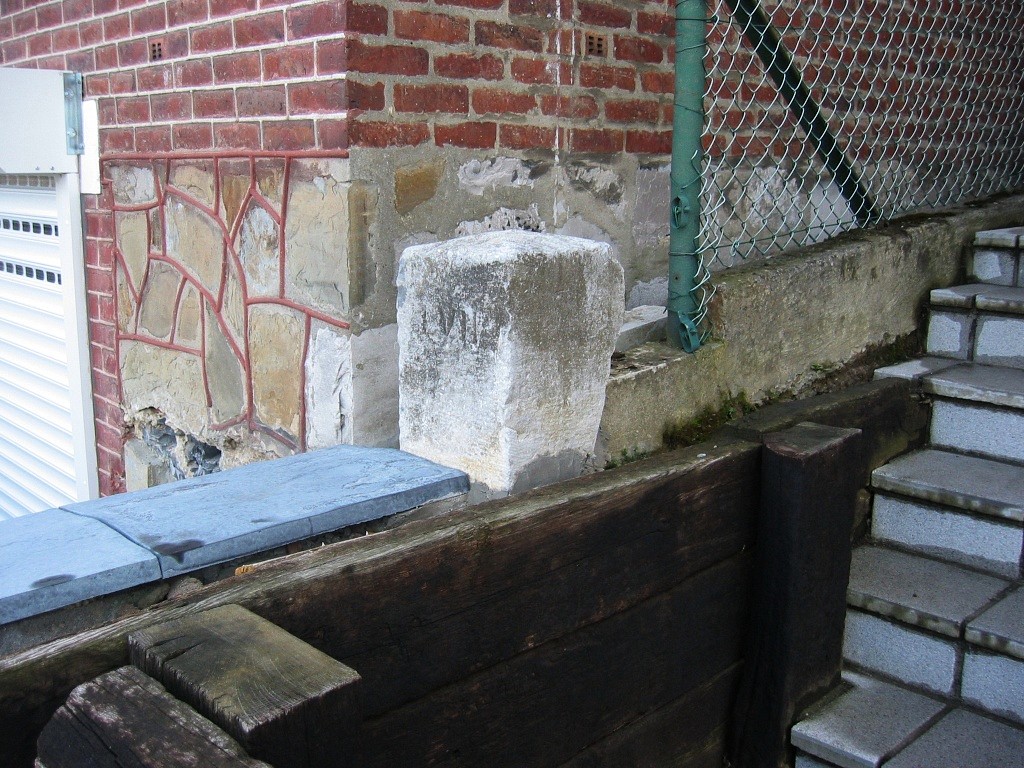
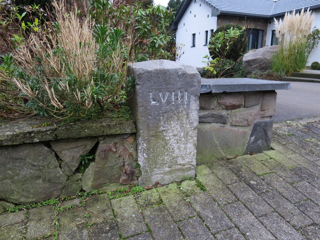
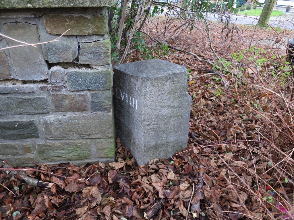
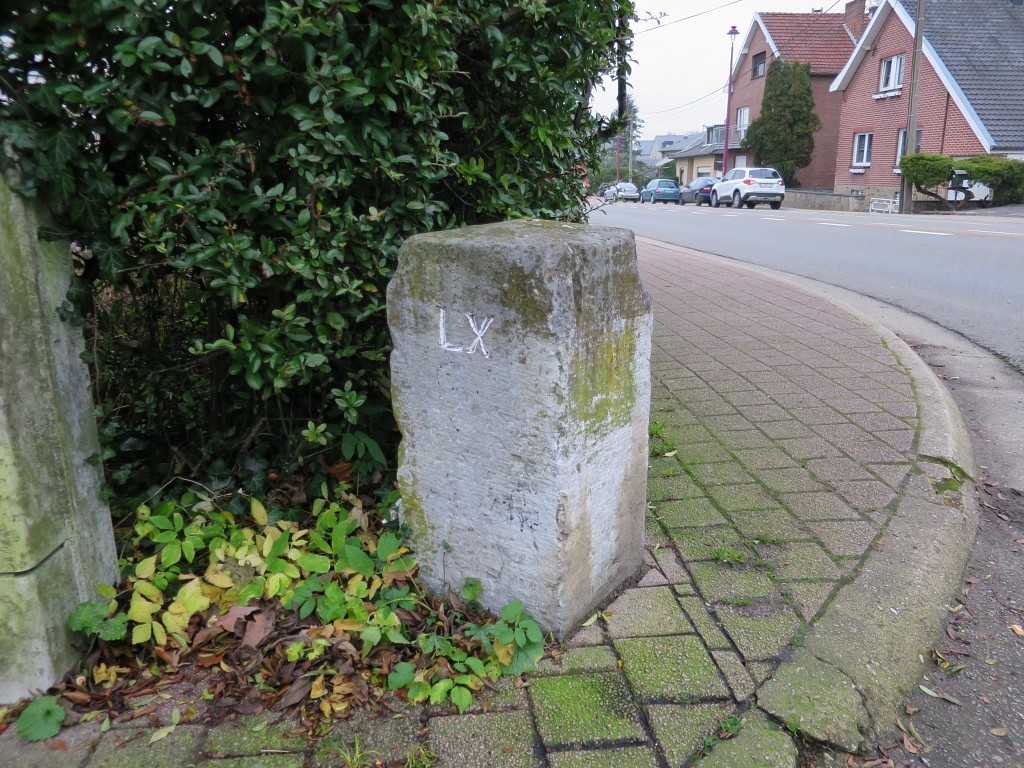
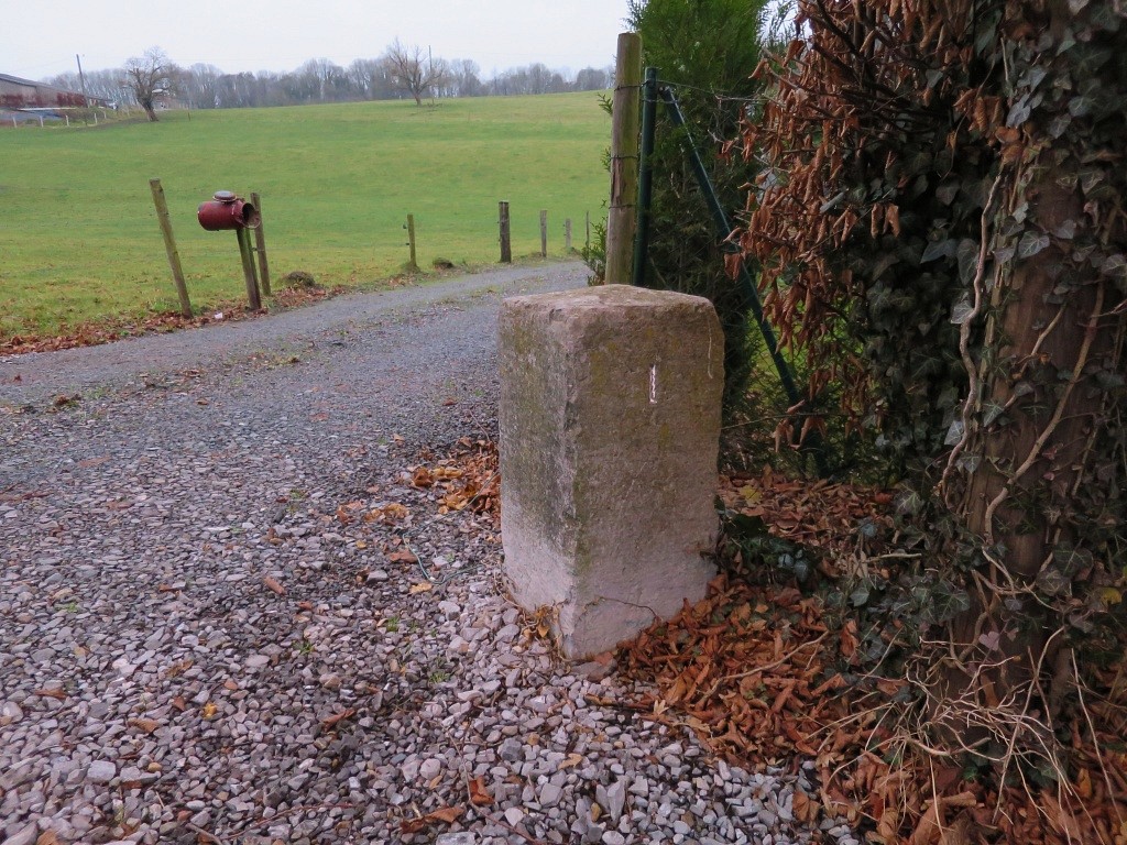
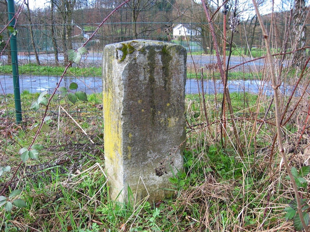
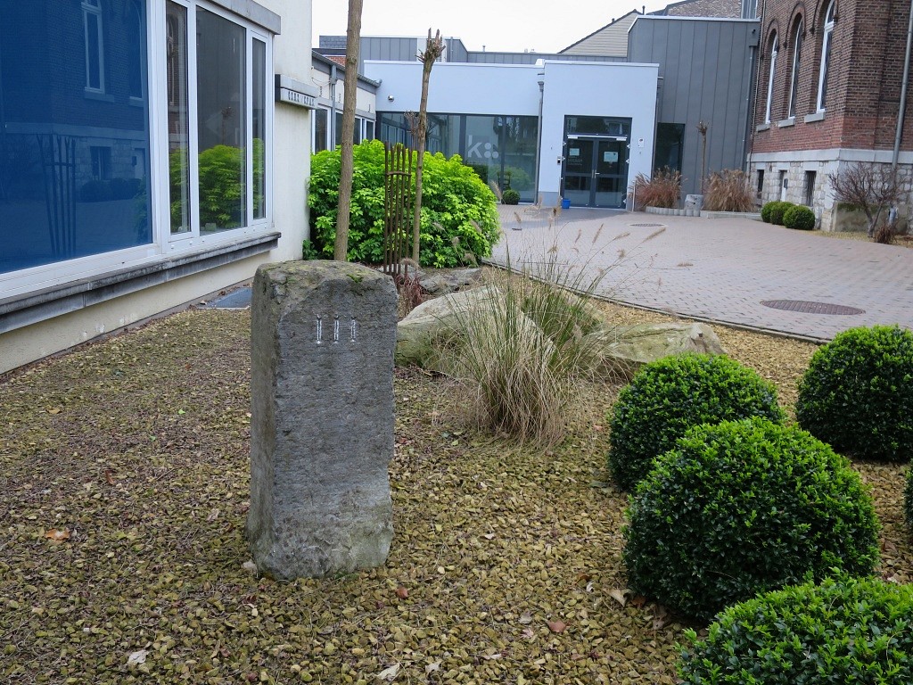
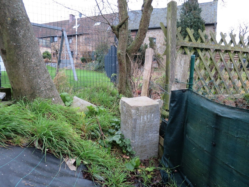
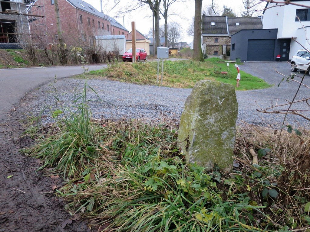
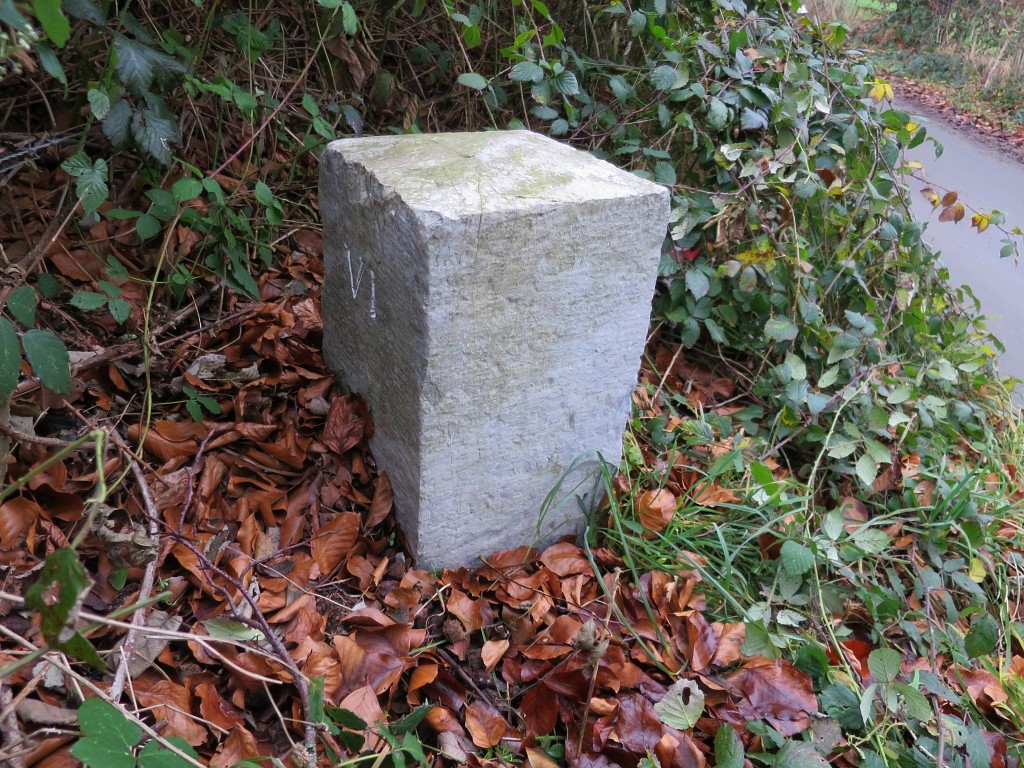
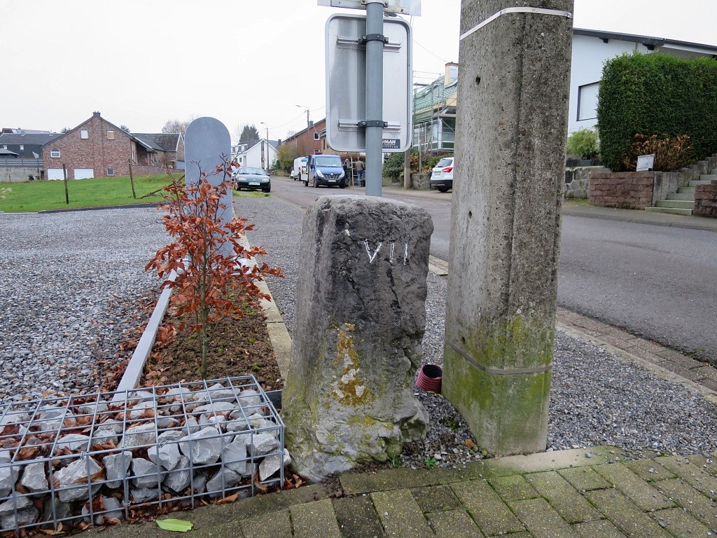
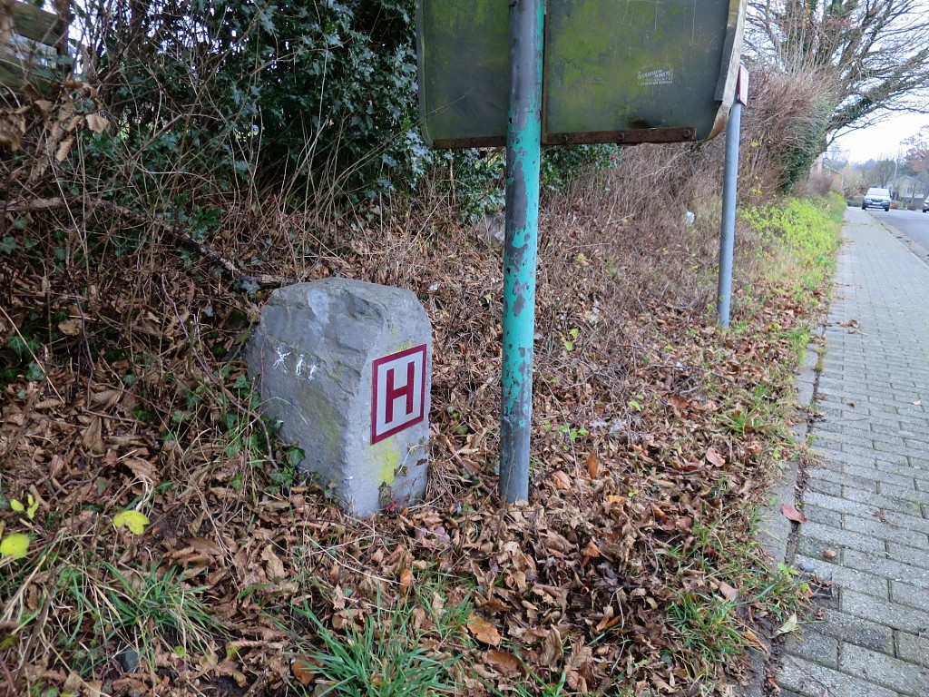
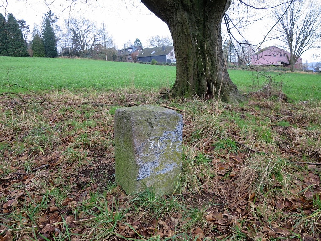
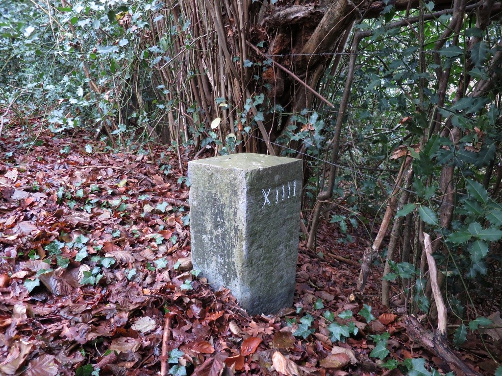
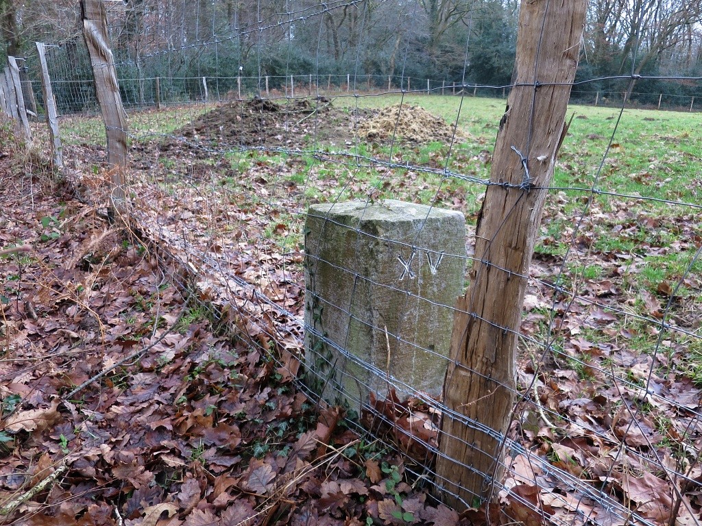
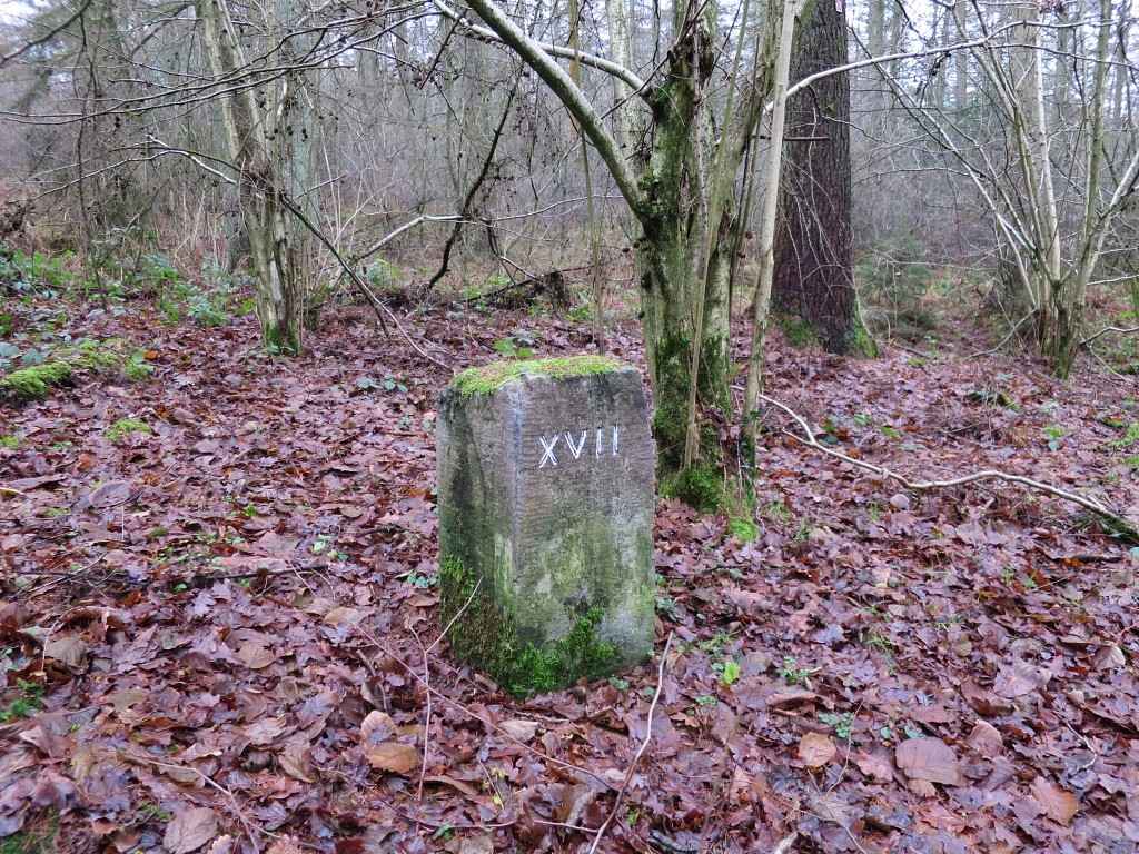
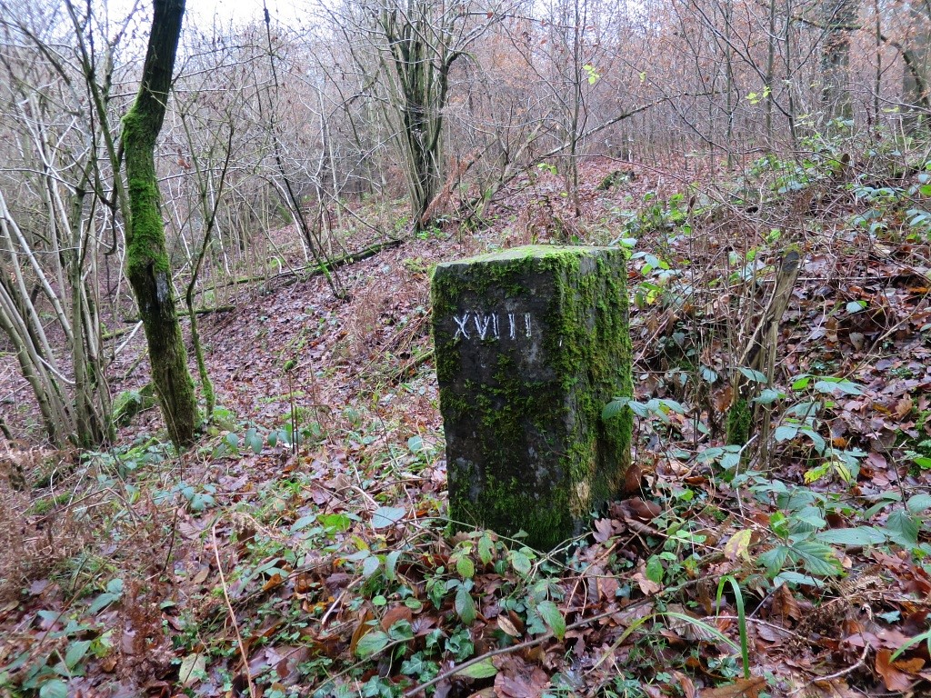
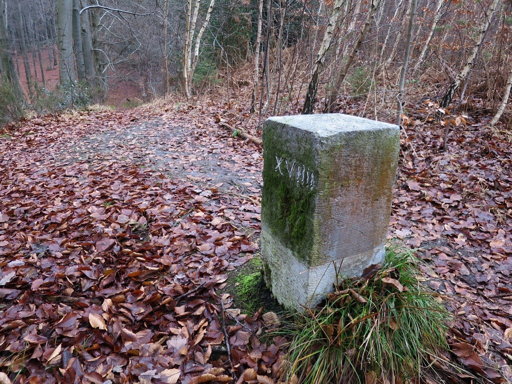
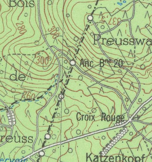
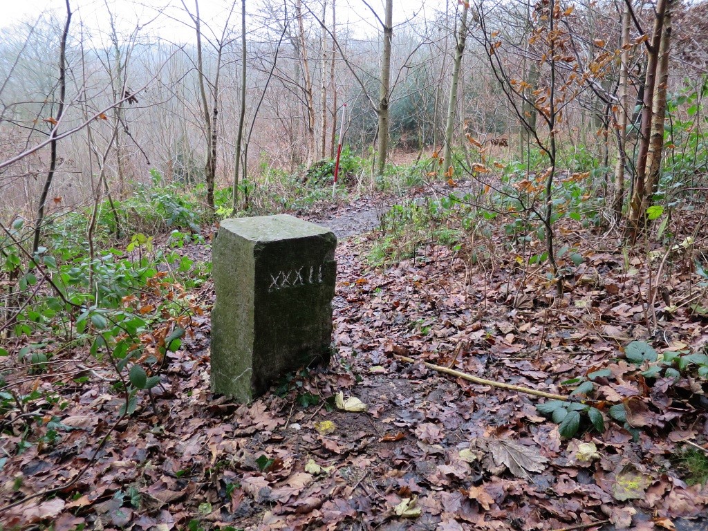
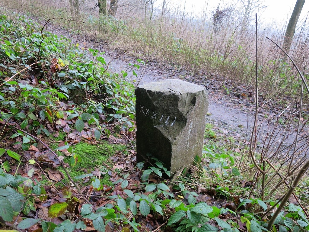
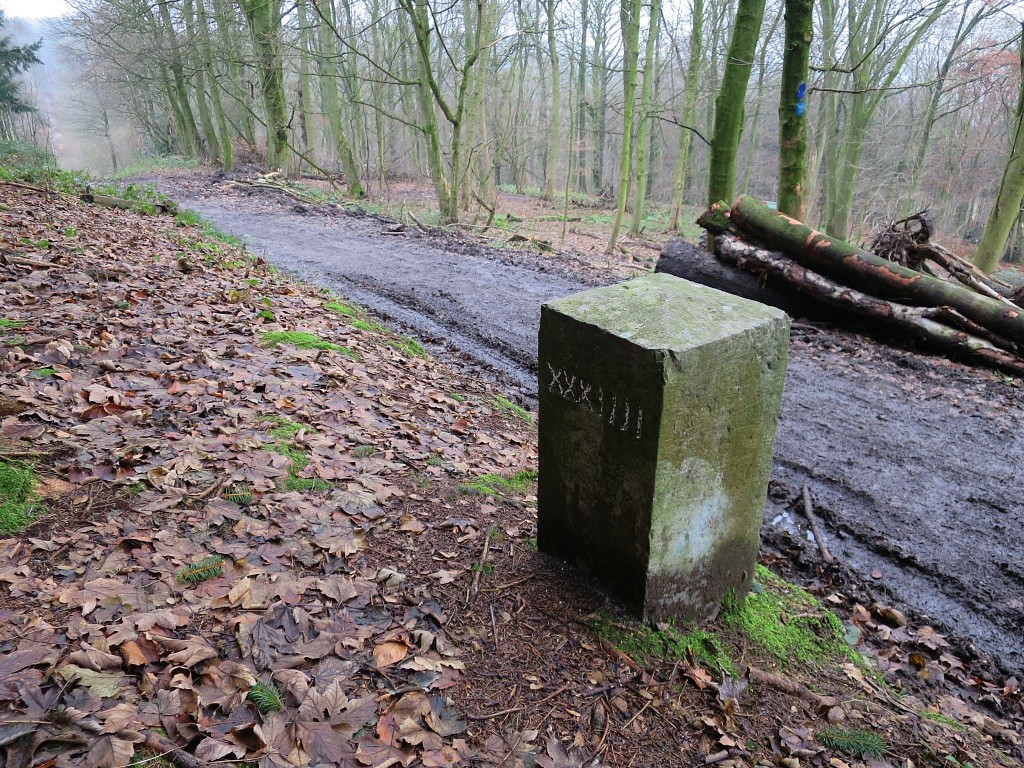
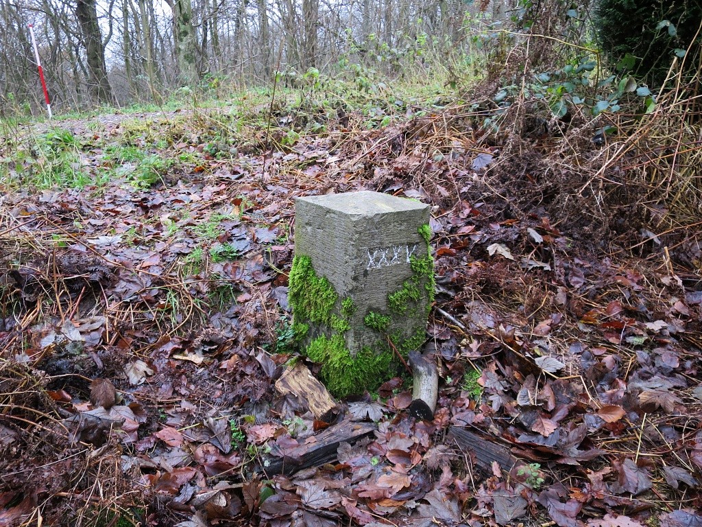
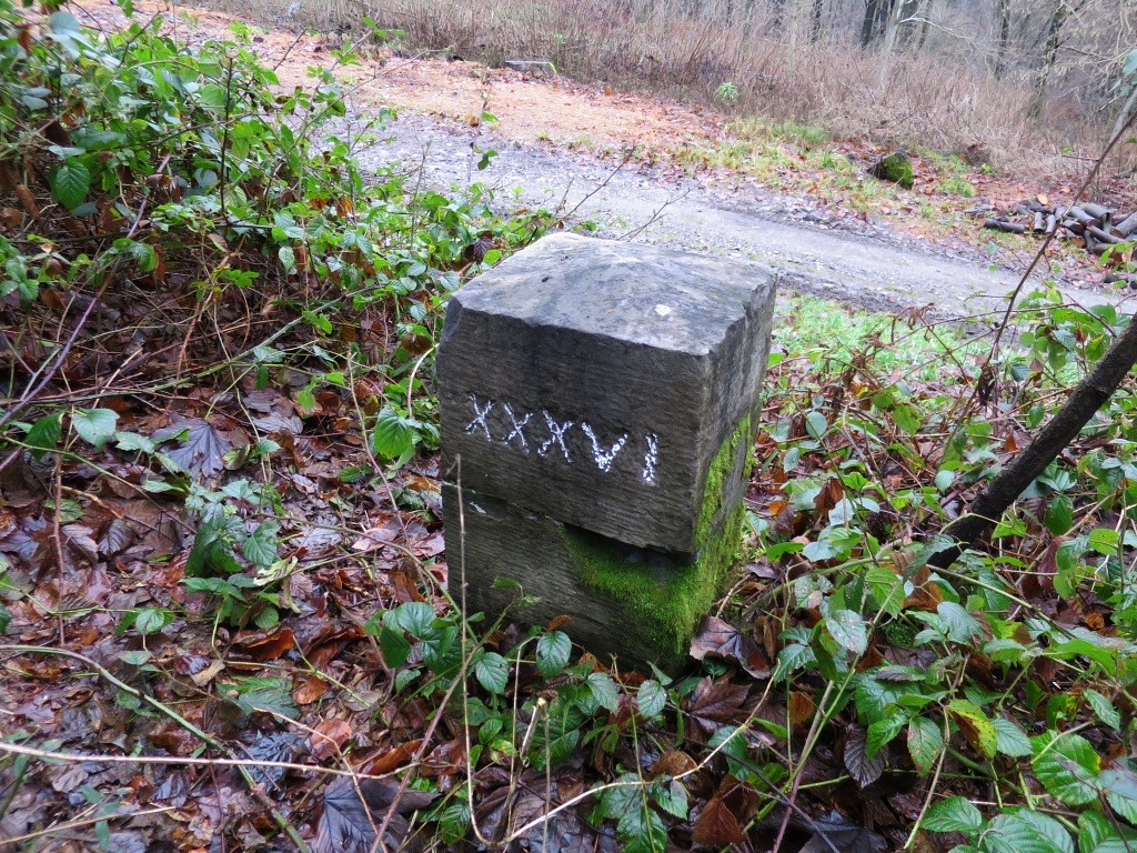
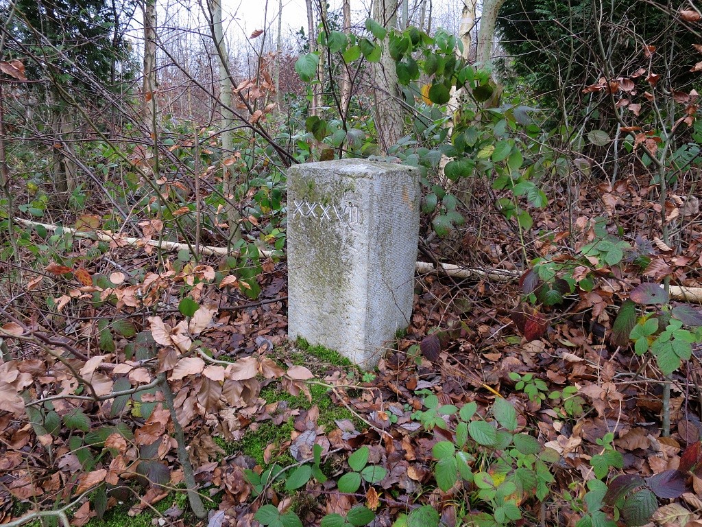
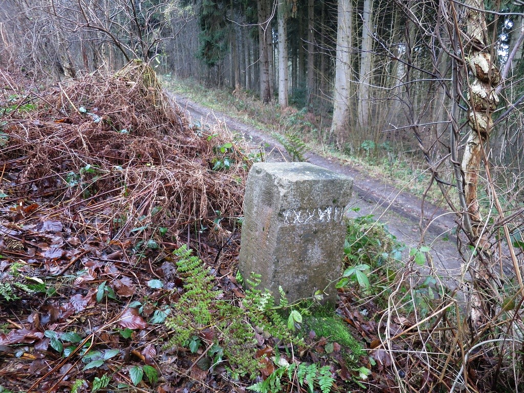
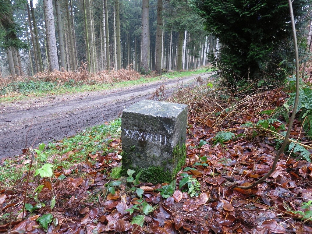
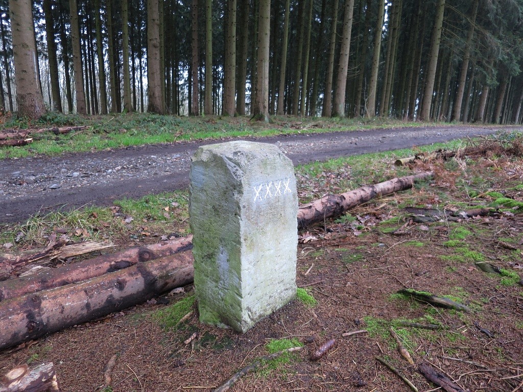
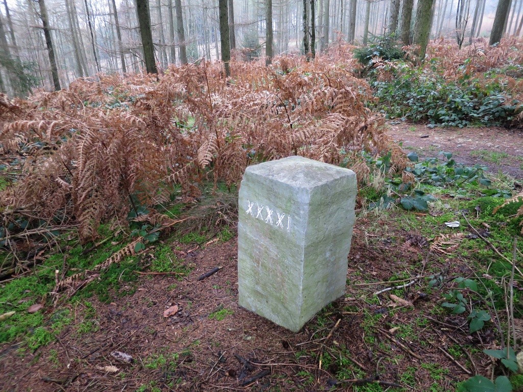
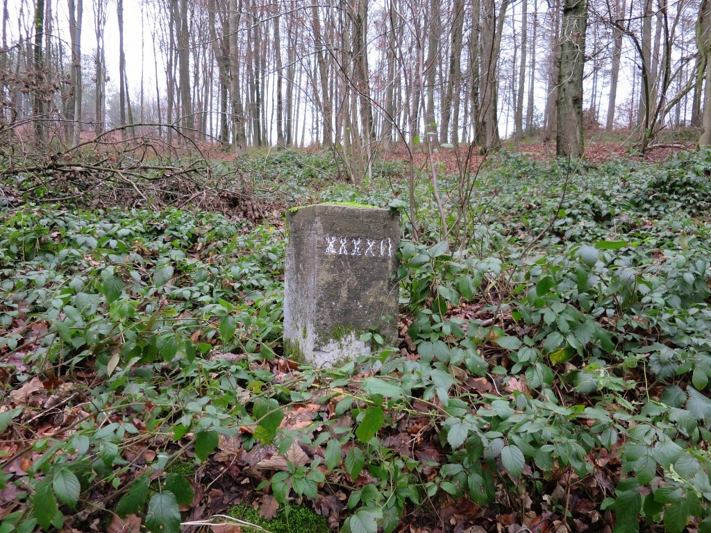
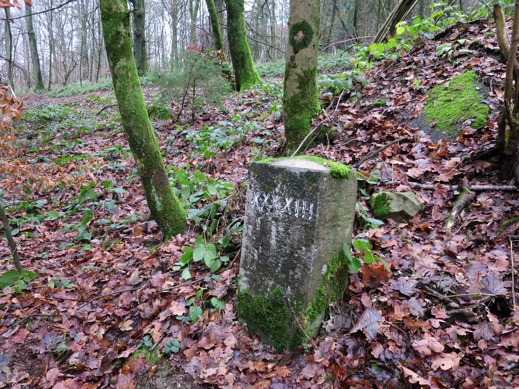
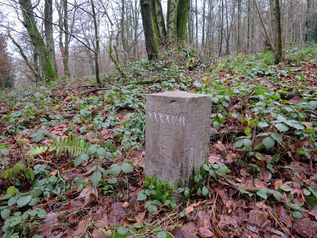
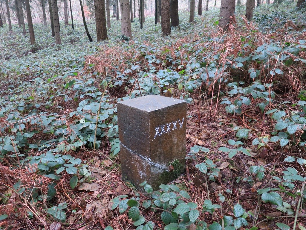
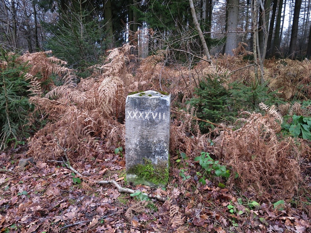
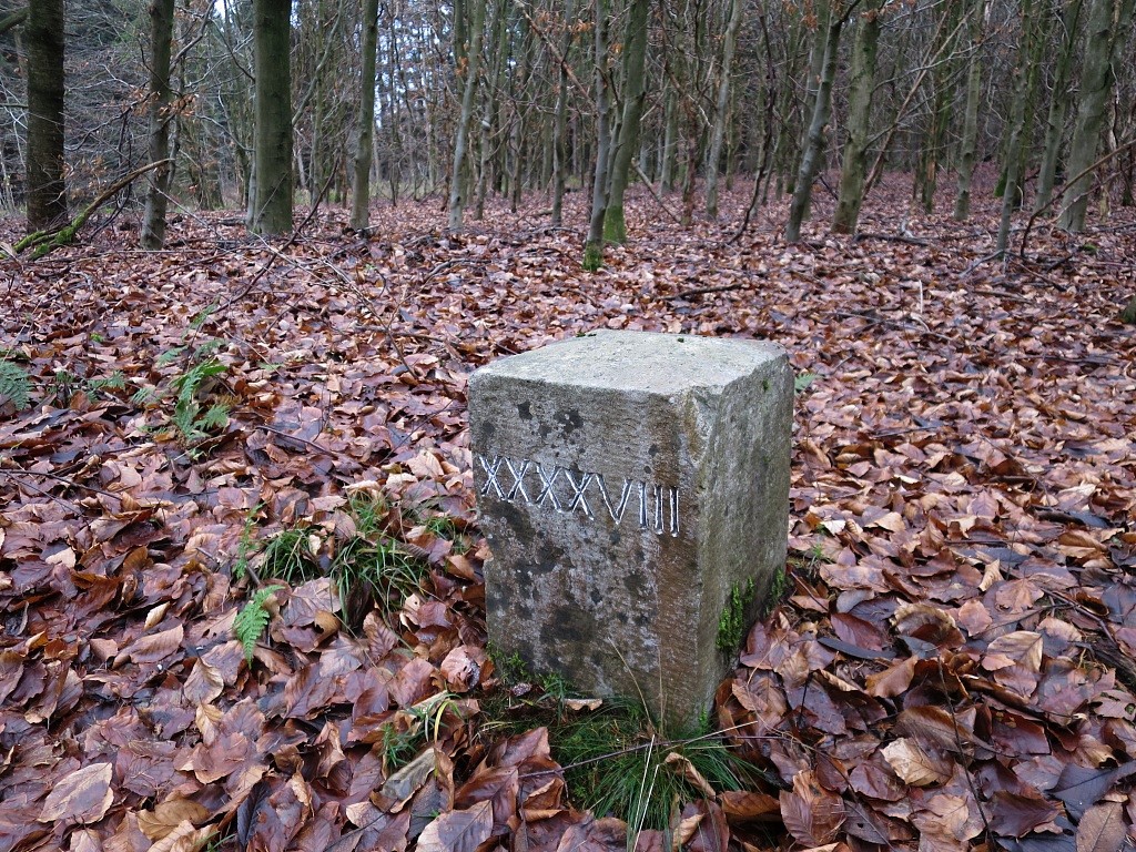
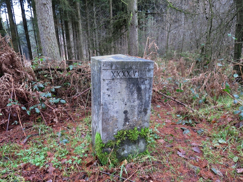
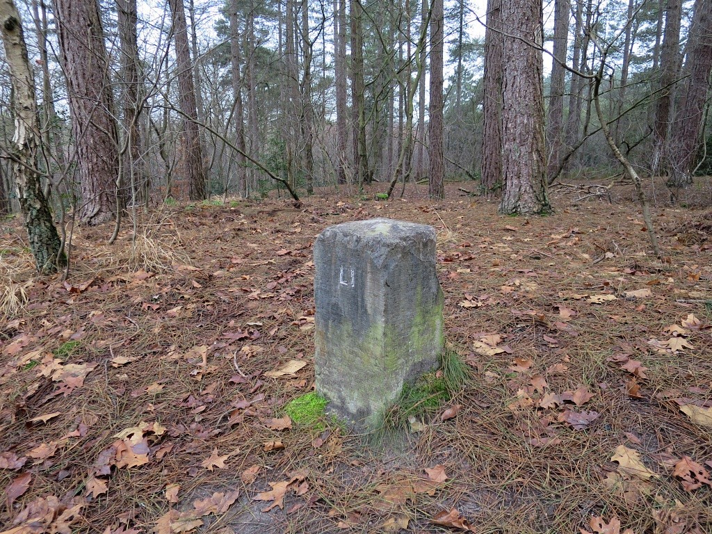
state ('Neutral Moresnet'), it might be better described as a condominium.The border situation changed when Belgium left the Kingdom of the Netherlands in 1839 and thus became the eastern neighbour of Neutral Moresnet. But that didn't change the status of Moresnet. After WWI, Neutral-Moresnet was incorporated in Belgium. Photo-gallery of the bordermarkers: Scroll down or go directly to it Searching the bordermarkers Most of them still exist and were surveyed - in 2001-2002 in several trips together with Jannis Deeleman and for a part Wil Nous, summarized in this website - on 21-3-2004 together with Jannis Deeleman and 5 other men - on 17-12-2021 together with Jannis Deeleman - on 29-12-2021 with Antonia - on 8-3-2022 with Geert Krijnen Description of the Moresnet-borderline The triangular shape of Neutral Moresnet was described by the Traité d'Aix-la-Chapelle (1816) in the articles 15-17 (see full text). It's not an easy French to read but we can destillate the three borderlines of the triangle of Neutral Moresnet: the base is the Liège-Aachen-road (the road itself included) and from there two straight lines go north and converge at the bedenl-tripoint. The borderline has been reconstructed in this kml-file (Google Earth) and this gpx-file. See it online on this map. Three remarks: 1. the western borderline has been drawn following the current municipal borderline on the maps which passes through the current 'in situ' bordermarkers 1 to the bedenl-tripoint. However: that is NOT a completely straight line! It is an almost straight line but slightly curved to the east. I know another example of such a case along the dutch-belgian borderline between bordermarker 196 and 197. It should be a straight line but new measurements in 1957 revealed that the 5 intermediate submarkers were in fact placed on a slightly curved line to the east. As if the same deviation had crept into the original measurements. See this page (in dutch). 2. the eastern straight line from the bedenl-tripoint to no. 1 is much more in accordance with the actual positions of the bordermarkers. A few minor adjustments have been made to get most of the markers on that line. 3. the southern line is drawn along the southern edge of the current course of the Lütticherstrasse between no. 1 and no. 60. One may assume that in the 19th century that street was a bit narrower. A quadripoint from 1839 to 1919 When Belgium split from the Kingdom of the Netherlands, Moresnet became part of a quadripoint: 4 different countries meeting each other at one point, quite unique at that time and at present they don't exist anymore in the world. This is a picture of the bedenl-tripoint with the sharp northern Moresnet-point added as implemented in the pavement en with information boards. 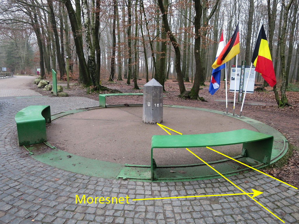 (click picture to enlarge) However, this is a wrong depiction as I discovered at 8-3-2022. The next picture shows the correct situation:  (click picture to enlarge) What is left of the Moresnet borderlines? The western borderline is nowadays a municipal borderline between Plombières and Kelmis AND the language-border between the French-speaking and German-speaking communities of Belgium. The eastern borderline has at present no function anymore, neither has the southern line. Moresnet-bordermarkers installed n 1818 the first (wooden) bordermarkers were placed. In its numbering it continued the row which already existed along the German border starting in Luxembourg. Bordermarker 188 was placed double in the southwest corner, bordermarker 193 on the present BEDENL-tripoint. Along the eastern border an identical row was placed with the same numbers. This is the appended map to the Traité of 1816 which shows them: 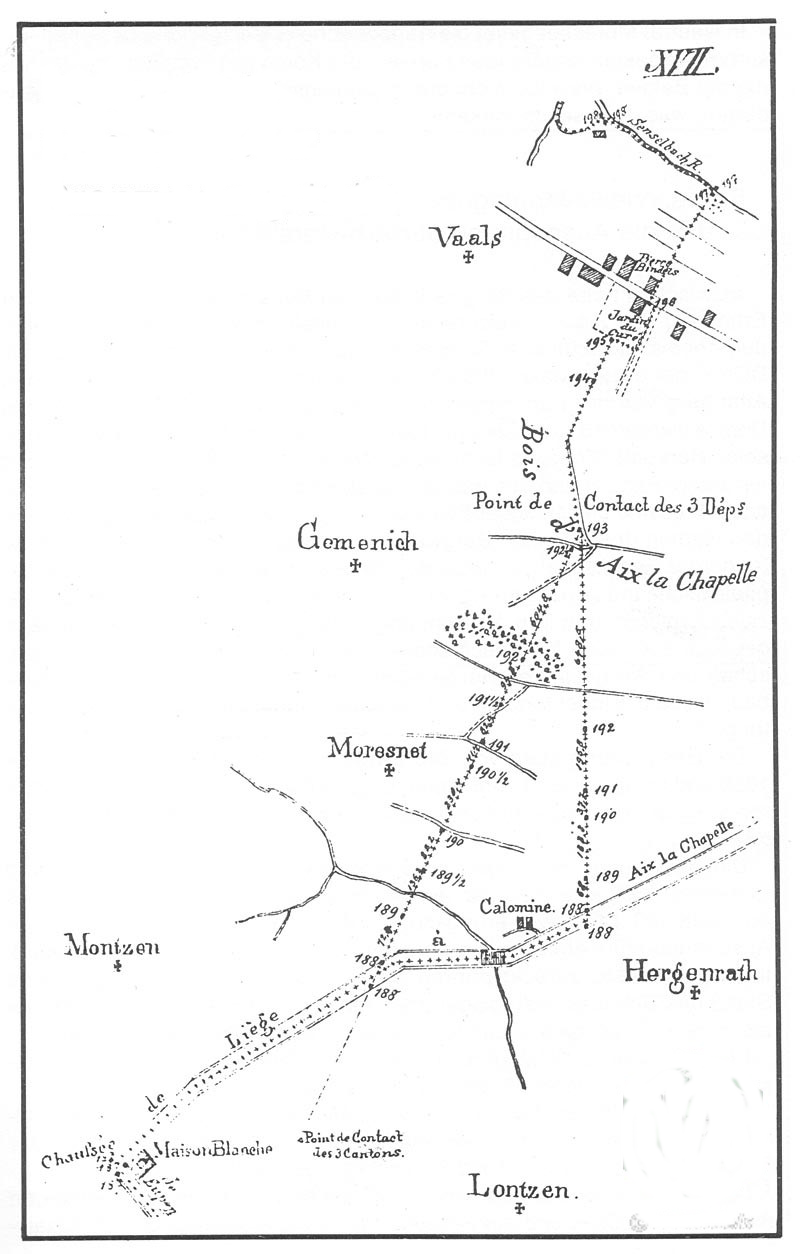 (Click map for an enlargement) In 1869-1870 the vulnerable wooden bordermarkers were replaced by 60 stone markers: in 1869 the eastern border and in 1870 the western border. The numbering was done in roman ciphers: bordermarkers I-XXX along the western border, bordermarkers XXXI-LX along the eastern border. The northern point remained bordermarker 193. The roman numbering on the markers is however unusually (though not unusual in clockworks): 4 became IIII and not IV, 9 became VIIII and 40 becomes XXXX. So far, I haven't found an original map or description of the exact original locations. The bordermarkers themselves Information provided by Michael Stein: width 30x30cm, the pyramide-top 3cm high, height 60cm above ground-level . The number was in principle engraved at the side of the neighbouring country but some of the markers have been turned in the course of time, for example after being uprooted and reinstalled by forestry activities. It is yet unknown what the source is of Michael for this information. In this article we read that the markers were made by one Franz Schoenauen. Each marker weighs about 200 kilo, is 110-120cm high and is 50-65cm under the ground. 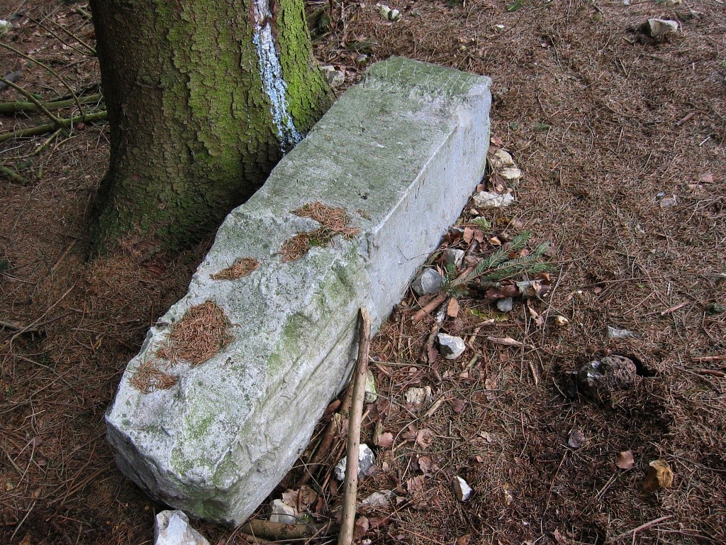 This picture shows a marker in its totality (no.38 in 2004)
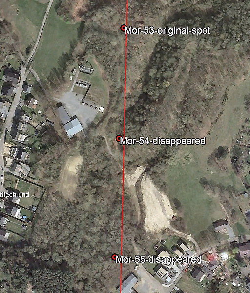
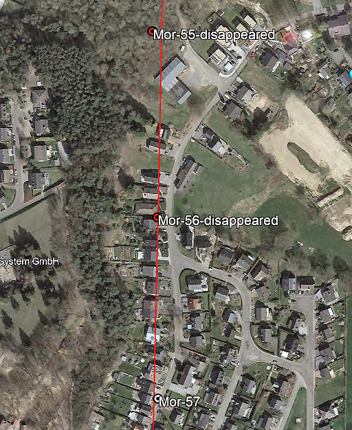
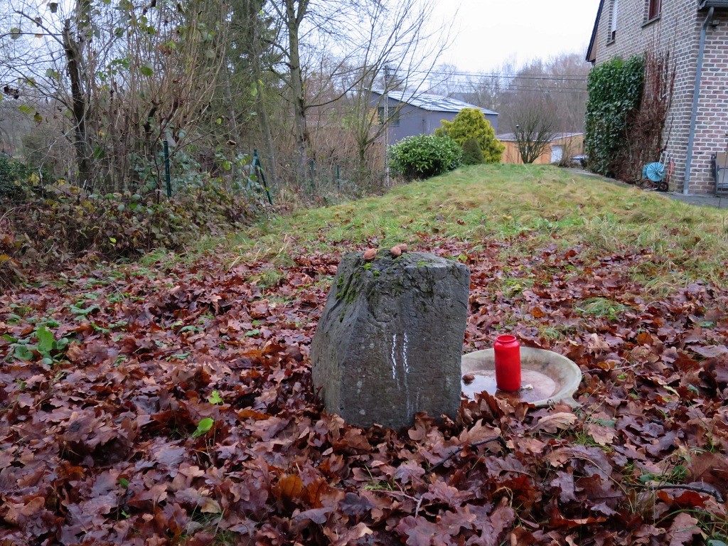
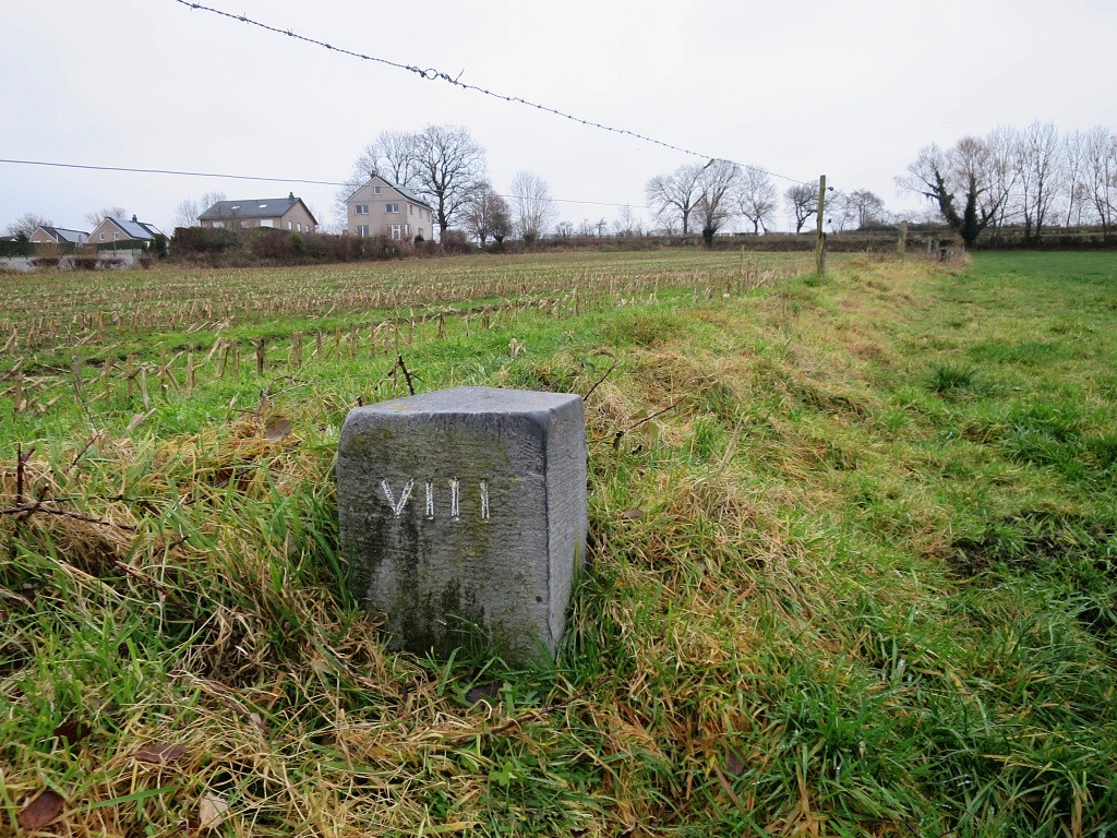
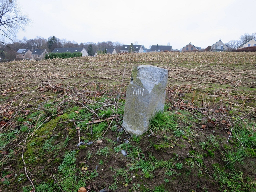
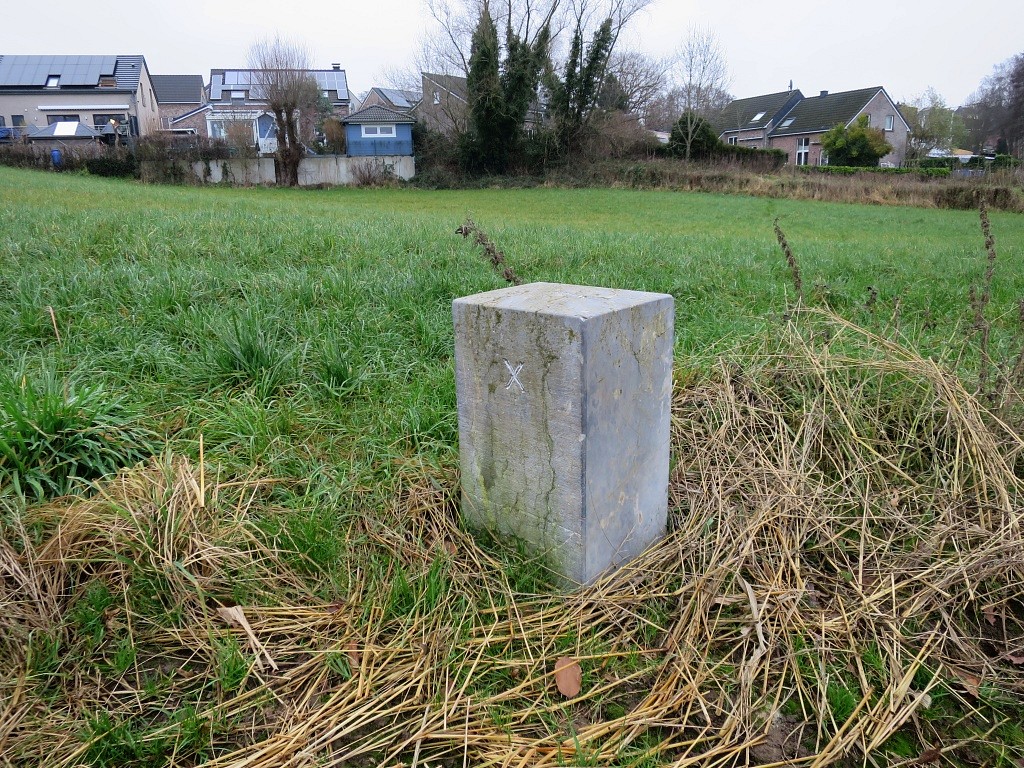
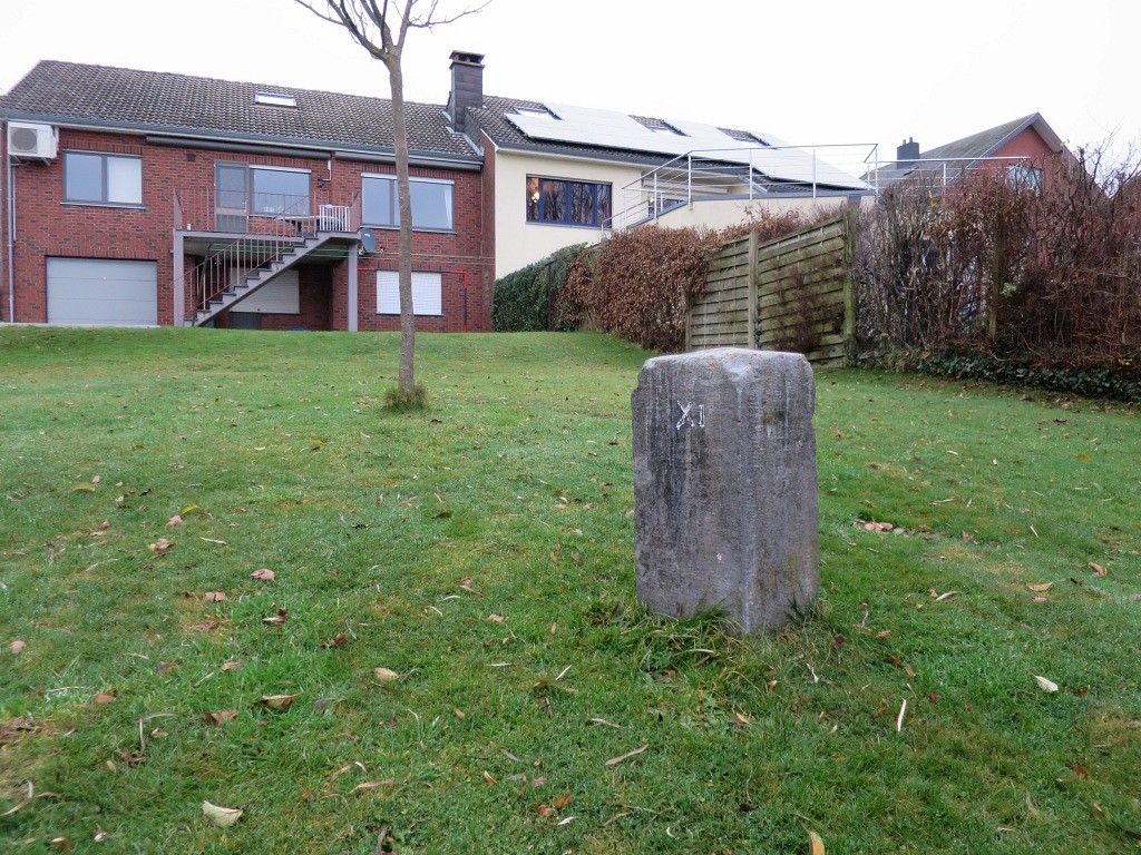
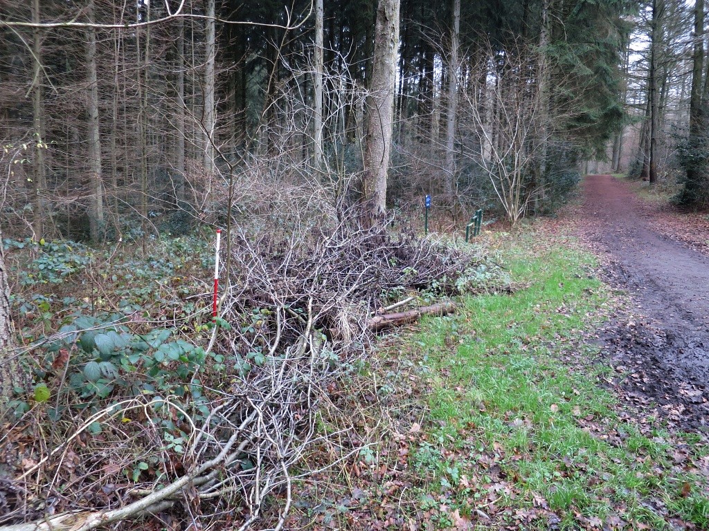
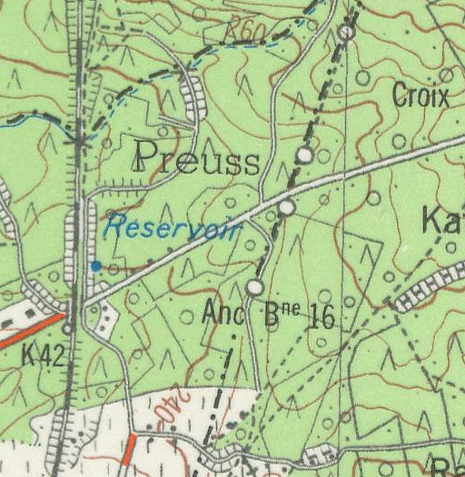
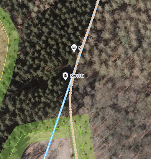
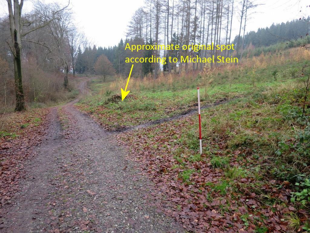
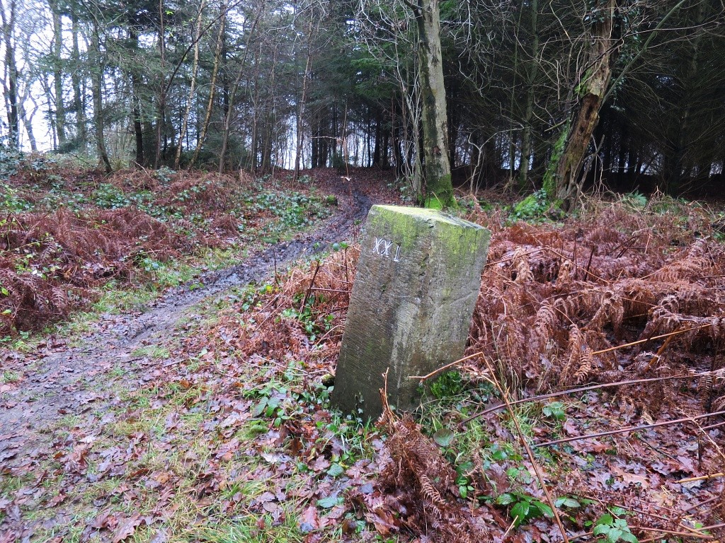
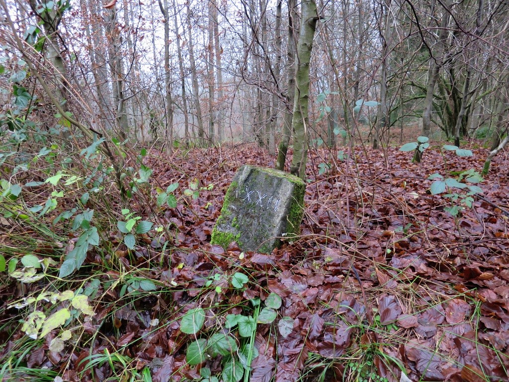
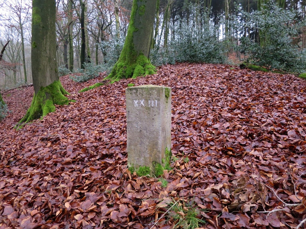
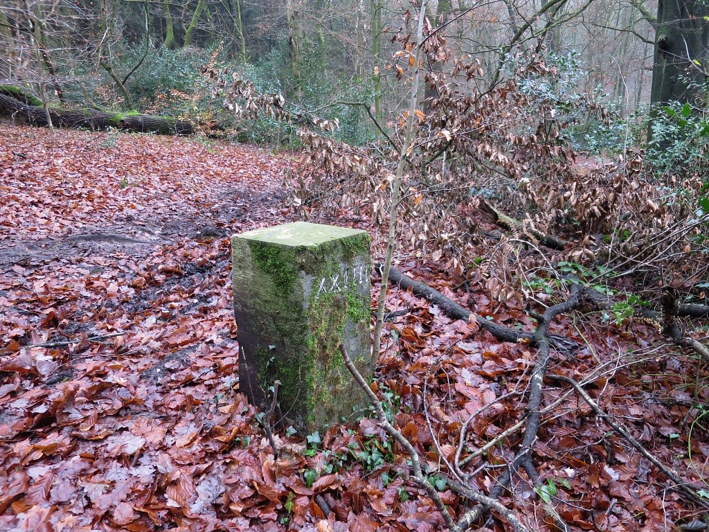
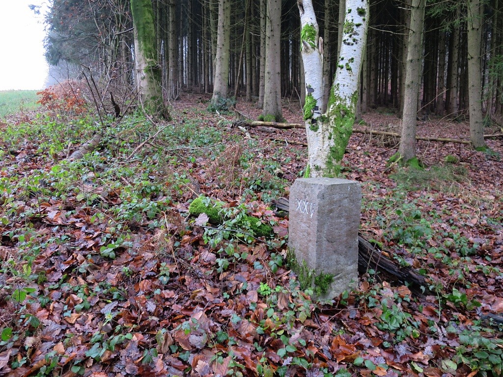
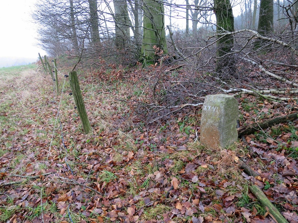
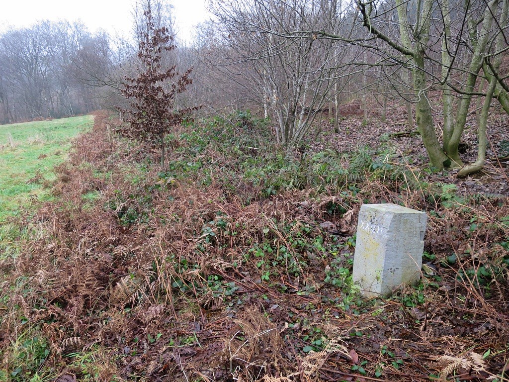
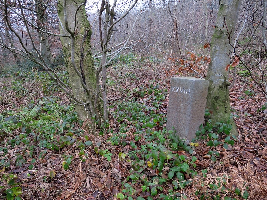
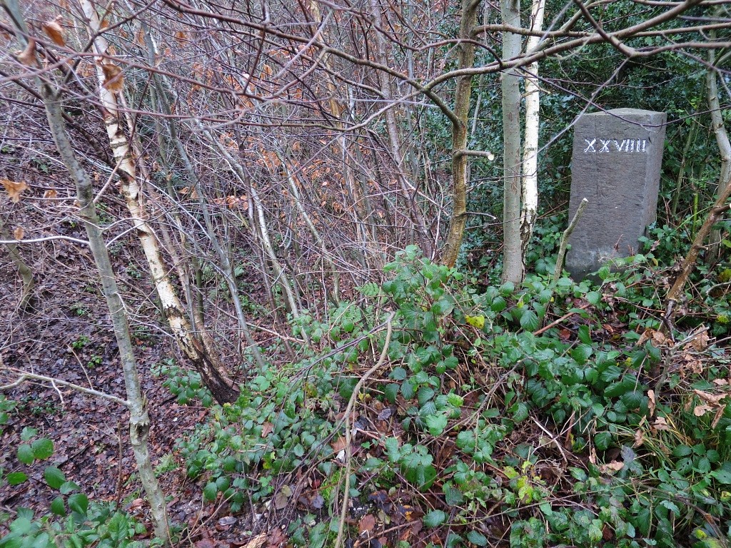
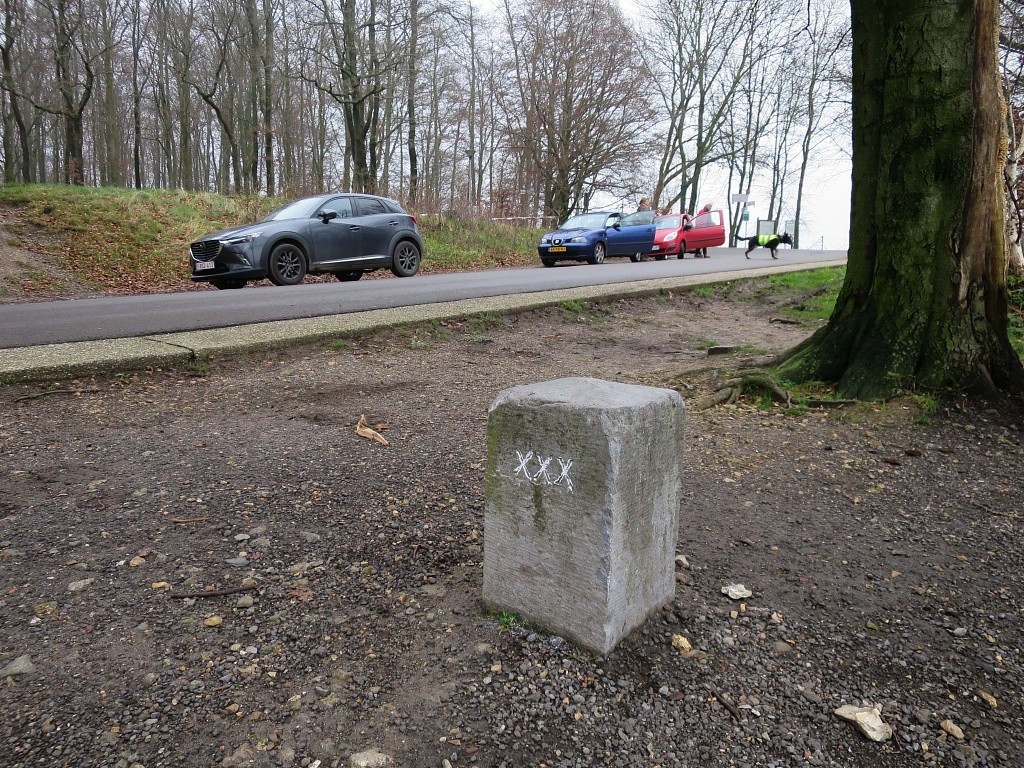
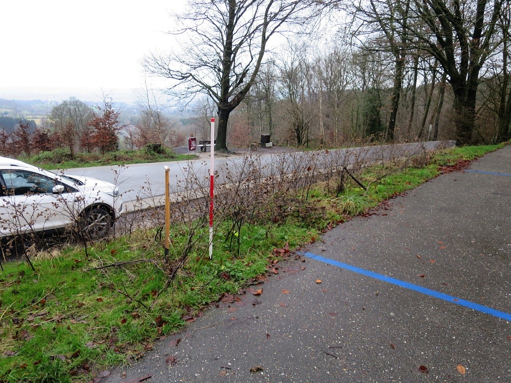
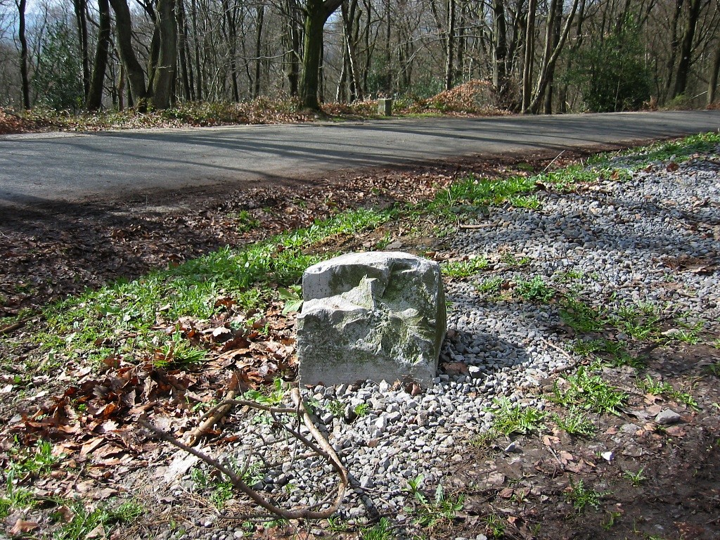
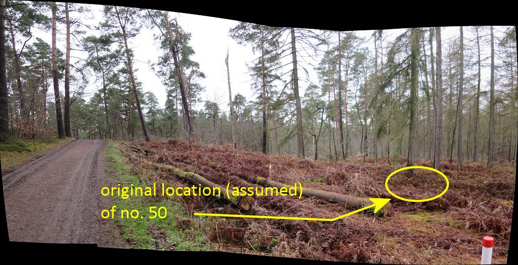
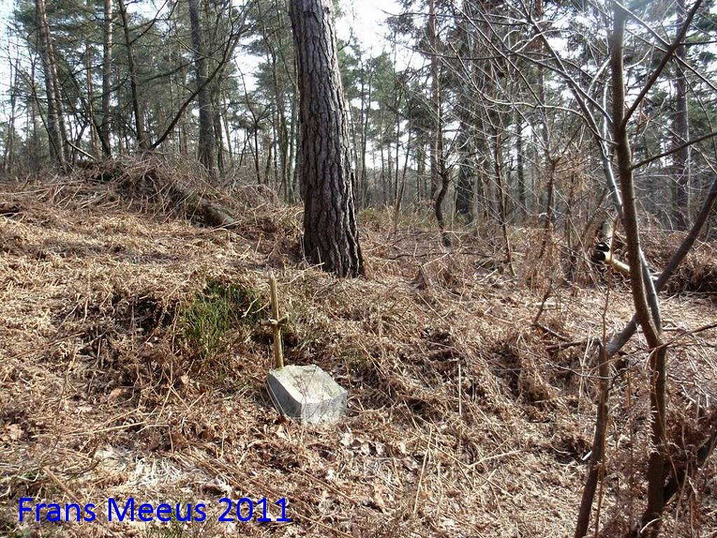
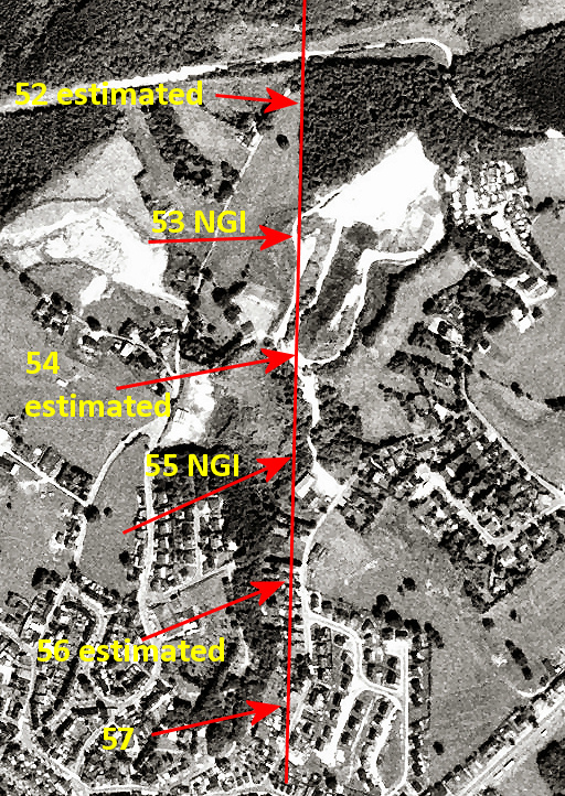
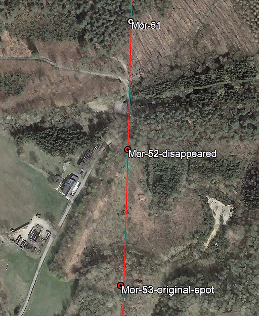
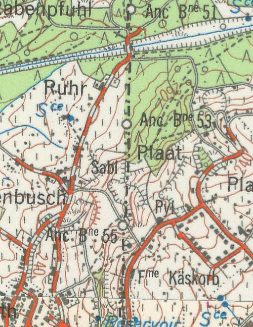
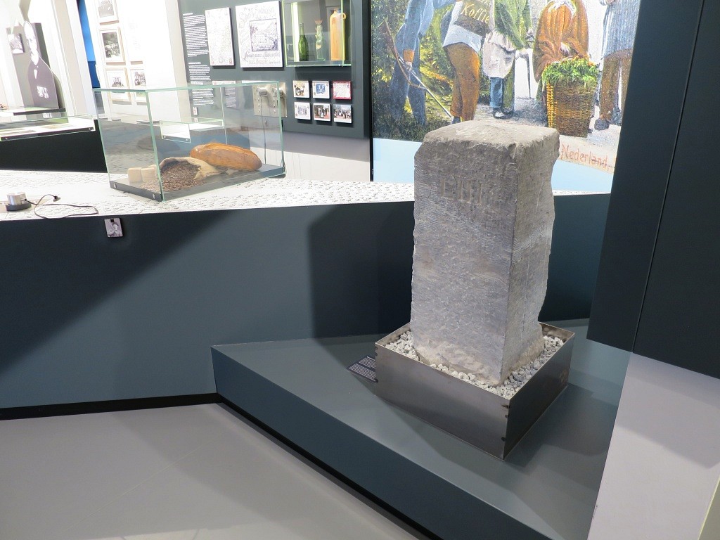
(Click on picture for an enlargement): Maintenance of the markers Of the 60 markers, there are still 50 markers 'in situ' (spring 2022). The nos. 3 and 53 are placed elsewhere. No. 50 has disappeared in recent years but will be remade and replaced. That leaves 7 markers (16, 20, 31, 52, 54-56) which are lost without any effort known to replace them in the future. It is still amazing how many markers survived because they lost their function in 1919 and they don't have a protected status as a heritage-monument. Anyway, there is definitely a kind of tradition of maintenance cq preservation of the markers. In 2004 there were three markers uprooted, all neatly reinstalled in 2021. We also see markers which are new ones, having replaced old markers for whatever reason. In this article several cases of replacement, maintenance, restoration etcetera are described. The municipality of Kelmis was involved in most of these cases. Coordinates - all coordinates are in this kml-file (Google Earth) and this gpx-file (note: initially based on a gpx by Boudewijn Palthe and improved with my own gps-measurements and corrections using maps, Google Earth and other information. Some of the locations of the missing markers are estimated positions and thus hypothetical) - see them online (including the borderline) on this map Maps to download - Moresnet-map with borderline and bordermarkers, projected on an actual OpenTopoMap-base (1450x3650px) - Moresnet-map with borderline and bordermarkers, projected on an actual 4UMaps-base (1500x3800px) with lots of walking trails indicated Maps online - topotijdreis.nl shows Moresnet on dutch maps from the 19th century onwards. However no bordermarkers shown - Opentopo.nl is a great dutch mapping project using only open source data, use the ArcGIS-option for the online mapviewer. The maps extends a bit into Belgium showing also the Moresnet-area. However: no bordermarkers shown - historic.places shows the first generation of the Moresnet-bordermarkersmarkers as well as the second one, projected on several historic mapbases - topoviewer IGN Belgium: actual digital map with a lot of bordermarkers shown if you zoom-in, however no information indicated like the numbers. - Cartesius shows Belgian historic maps on which the Moresnet-area is included after WWI when Moresnet became part of Belgium. Sources / additional information - Almost everything about Neutraal-Moresnet could be found in the past on the discontinued website www.moresnet.nl of Cees Damen. On the Internet Archive a partial copy can still be seen. - Wikipedia: english article. You might also check the French and German versions because they are not identical - Michael Stein (chairman of the museumsociety of the Museum Vieille Montagne) who kindly provided additional information, he also organises walking tours in Moresnet). - Museum Vieille Montagne (Lütticher Straße – Route de Liège 278, B-4720 Kelmis – La Calamine). Fine museum abou the history of Moresnet. Céline Ruess - director of the museum - wrote me in 2022 that the bordermarkers do not enjoy a protected status as a cultural heritage and that they don't keep a photographical documentation of them. But they do have the bordermarker 53 on exhibition and perhaps still in their collection a part of marker 16. - Grenzbezeichnung des Neutralen Gebietes van Moresnets - Franz-Xaver Schultheis (2 articles published in Im Göhltal, nos. 28 und 29 (february and august 1981) -> a very detailed article about the demarcation of Neutral-Moresnet but primarly focussing on the wooden predecessors of the current stone markers. - Grenzsteinwanderung um Neutral-Moresnet -Peter Kurnap & Dieter Pitz (2 articles published in Im Göhltal, nos. 83 and 84 (2008/2009) with a detailed description of a walk along the bordermarkers - leaflet of a walking route along the Moresnet-border using numbered walking hubs. As a hardcopy free available at the Tourist Office in Kelmis. Other photo-reports of the Moresnet-bordermarkers - Peter Dirven (2004) - Aafko Tuin (2011) - Frans Meeus (2011) - Marc van der Steen (2021) - note: large pdf - 41mb - Boudewijn Palthe (2021) - Jannis Deeleman (2021)
Photo-gallery of the bordermarkers - current situation (spring 2022)
|