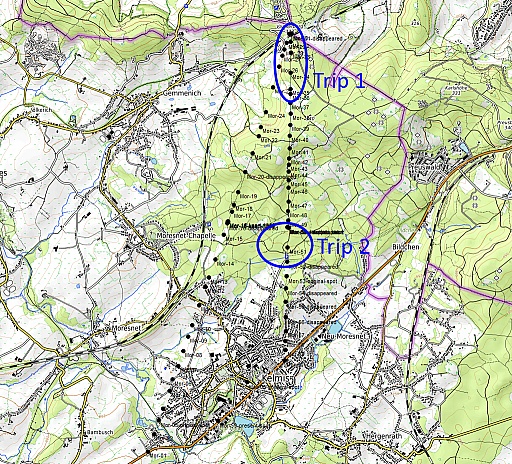
(028-afbeelding-plattegrond-both-trips)
Both trips on one map.
|
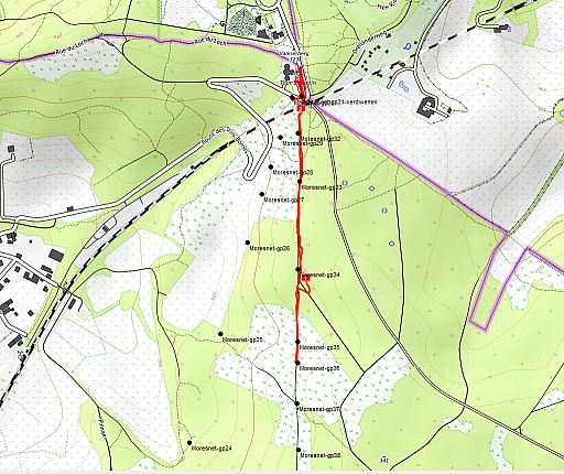
(029-afbeelding-plattegrond-trip1)
This is our first trip, having parked at the BEDENL-tripoint.
|
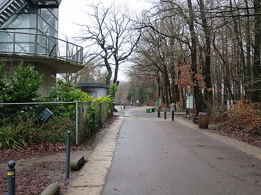
2021-12-29 - 09:23:59 (030-IMG_8460)
From the Belgian parking first to the tripoint
|
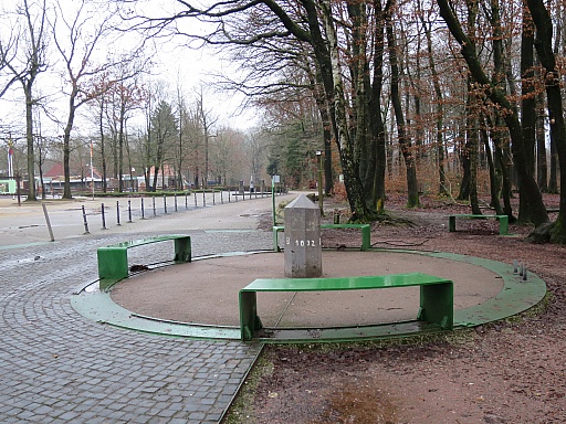
2021-12-29 - 09:24:54 (035-IMG_8462)
of Belgium, Germany and the Netherlands.
|
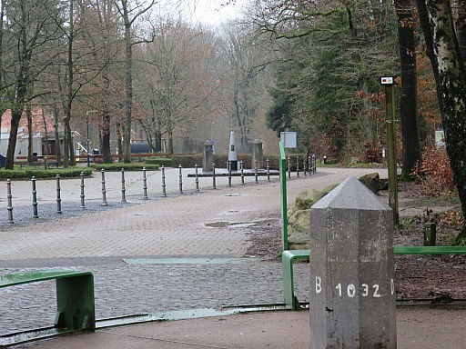
2021-12-29 - 09:25:03 (040-IMG_8463)
The number 1032 refers to the BEDE-border with no. 1 at the
BEDELU-tripoint in Ouren and this pillar being the last bordermarker.
At the other side there is a no. 193. This pillar was once part of a
long continuous borderline between the 'first' kingdom of the
Nederlands (1813 - 1839, Holland and Belgium together) and Prussia with
no. 1 in Schengen and no. 862 near Deventer and no. 193 here.
Then we still miss something: no. 1 of the BENL-border which starts
here. Well, the typical ironcast bordermarker no. 1 has been moved at
an unknown date to the spot in the background for apparently touristic
reasons, no longer at the border.
|
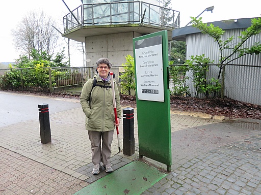
2021-12-29 - 09:25:18 (045-IMG_8464)
But once - from 1839 to 1919 - this tripoint was a quadripoint: the
meeting point of four countries: the Netherlands, Belgium, Germany AND
Neutral Moresnet.
Note: Neutral Moresnet existed from 1815 but only from 1839 - when
Holland and Belgium officially split apart - this point became a
quadripoint.
|
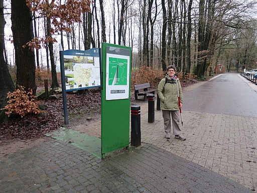
2021-12-29 - 09:25:27 (050-IMG_8465)
The old borderline of Moresnet is incorporated in the touristic design
of this tripoint but it is not that obvious at first sight. It is
Antonia who discovers that feature.
|
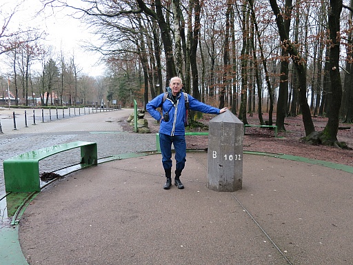
2021-12-29 - 09:25:52 (055-IMG_8466)
But first a picture of myself. It's my birthday today and today's trip is a kind of treat to myself.
|
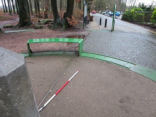
2021-12-29 - 09:27:18 (060-IMG_8468)
This picture shows the narrow nothern point of Moresnet
|
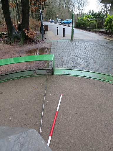
2021-12-29 - 09:27:30 (065-IMG_8469)
and this one a bit better. BUT: on 8-3-2022 I will discover that this is NOT a correct visualisation of the Moresnet-borderlines.
|
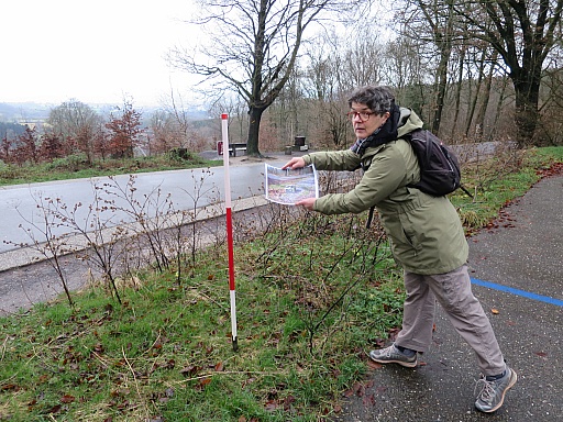
2021-12-29 - 09:30:17 (070-IMG_8471)
But now at work with our first target: a more precise positioning of
Moresnet-bordermarker no. 31 (which has disappeared) with help
|
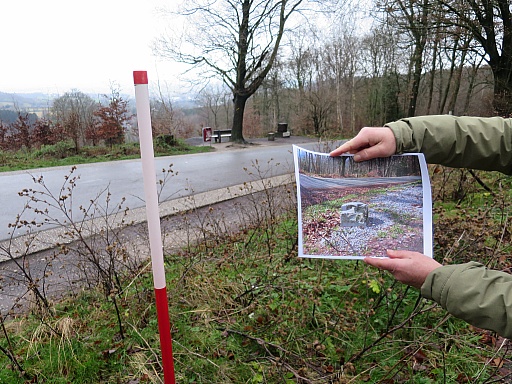
2021-12-29 - 09:30:23 (075-IMG_8472)
of a picture from 2004 when the marker was still present.
|
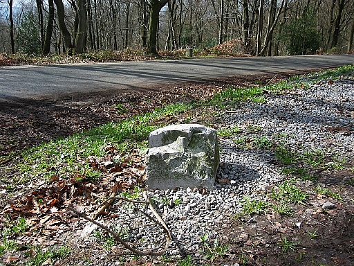
2004-03-21 - 13:50:52 (076-205-gp-moresnet-31-2004-03-21)
This is the picture of no. 31 from 2004, in the background no. 30.
|
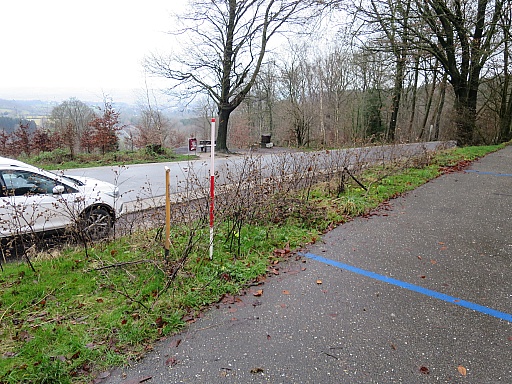
2021-12-29 - 09:40:39 (080-IMG_8473)
By comparing the old picture with the present situation, we establish this approximate spot (white-red pole).
|
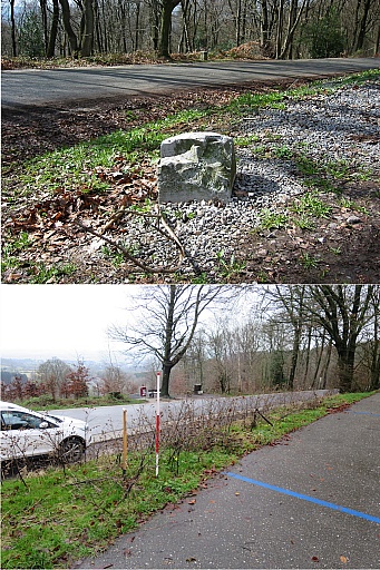
(082-Moresnet-gp31-comparison-2004-with-2021)
Both pictures combined.
|
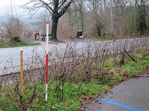
2021-12-29 - 09:40:49 (085-IMG_8474)
We pick a while in the ground with the pole. Perhaps it has been buried but we find nothing but some loose stones.
|
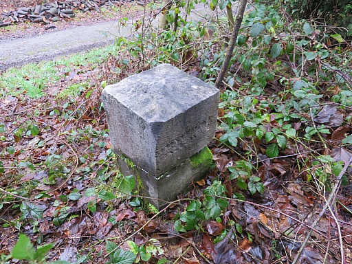
2021-12-29 - 09:59:52 (090-IMG_8475)
Then a walk along the eastern border of Moresnet on an easy path to no. 36. On my trip with Jannis Deeleman on 17-12-2021 we forgot this one.
|
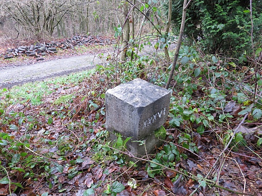
2021-12-29 - 10:02:42 (095-IMG_8476)
No. 36
|
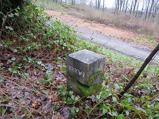
2021-12-29 - 10:03:07 (100-IMG_8477)
No. 36
|
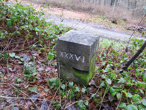
2021-12-29 - 10:03:15 (105-IMG_8478)
No. 36
|
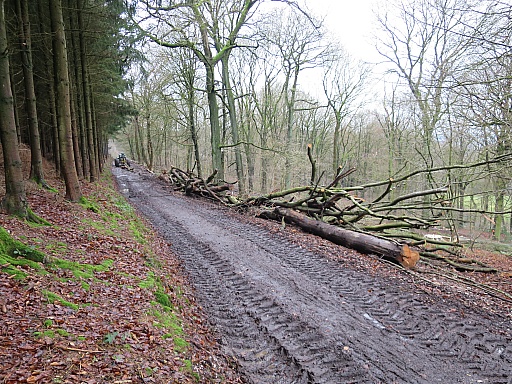
2021-12-29 - 10:11:11 (110-IMG_8480)
Back along this forestroad to the tripoint and the car.
|
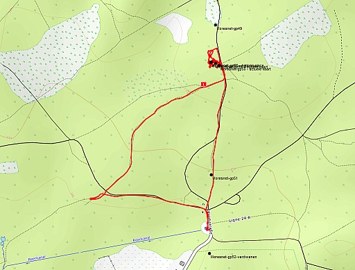
(113-afbeelding-plattegrond-trip2)
Map of the second trip, starting from a parking in the south.
|
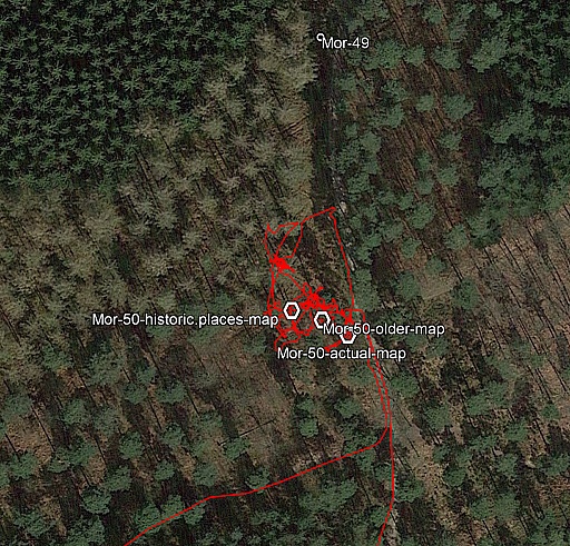
(114-afbeelding-plattegrond-trip2-detail)
Our target is another search for no. 50. The map above shows three waypoints derived from various maps. But on 17-12-2021 Jannis and I could't find it.
Also in this case I have brought an old picture and I hope to establish
the original spot by comparing the old picture with the present
situation.
|
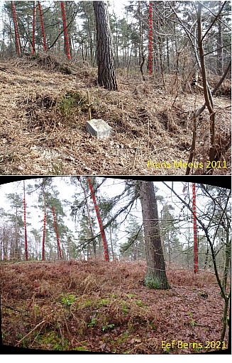
(115-Gp50-foto-FM-2011-vergeleken-met-foto-EB-2021)
The old picture is from Frans Meeus and dates from 2011. It is the last known photo of ths marker.
I am quite positive in having refound the original spot of no. 50 by
comparing the background on the old picture with the present situation.
Best to enlarge the picture by clicking on it and see for yourself.
|
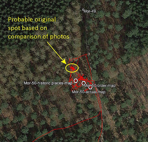
(119-afbeelding-plattegrond-trip2-detail-2)
That results in a waypoint as indicated on this picture. We do a lot of picking around with the pole but to no result.
|
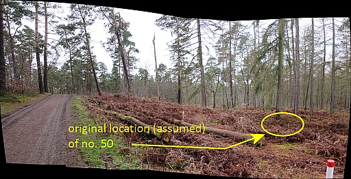
(120-IMG_8488-92_stitch-with-annotations-1024px-sharpen)
Same spot but now seen from the forest-road. Later Michael Stein will
write me that this marker has indeed disappeared and that they are
making a new one.
Then we walk in the direction of no. 16 but abandon our plans when it
starts to rain. We drive to Kelmis for a delicious birthday-lunch since the
dutch restaurants are still closed because of the covid-19-crisis.
|


